Travel
TOUR INFO
National Highway 66, commonly referred to as NH 66 (Erstwhile NH-17 and a part of NH-47), is a busy National Highway that runs roughlynorth–south along the western coast of India, parallel to the Western Ghats. It starts at Panvel, at the junction of National Highway 4 (NH4), and ends at Kanyakumari. NH-66 mainly traverses through the west coast of India, sometimes touching the shores of the Arabian Sea. The NH66 touches the Arabian Sea at Maravanthe in Karnataka, Thalassery, Alappuzha and Kollam in Kerala. It passes through the Indianstates of Maharashtra, Goa, Karnataka, Kerala and Tamil Nadu.
The NH 66 connects the interior parts of the coastal regions with the rest of the country. The NH 66 connects the major sea ports of WestIndia, Mumbai, JNPT at Nhava Sheva, Mormugao (MPT), New Mangalore (NMPT), International Container Transshipment Terminal, Kochiand Ratnagiri Port and other important ports like Beypore Port, Kollam Port and Vizhinjam Port.

Hence this National Highway 66 allows for the movement of goods by trucks from the hinterland to the major sea ports of India. Trade andcommerce in the region have increased due to the expansion of markets for agricultural products and seafood produced in the regionconnected by this highway. The formation of NH 66 has led to the development of tourism in the region connected by this highway. Goa stateis a classic example of this development. Many industries have been set up along National Highway 66, taking advantage of connectivity andproximity to ports on the Arabian Sea. The highway was the only source of connection between areas in the coastal districts, until the KonkanRailway was opened in 1998, between Mumbai and Mangalore.
The NHAI has received the approval to upgrade the complete stretch of highway, from start to end, to a four-lane highway, which will be 60 meters and grade separated. Out of four states through which the highway goes, Karnataka and Maharashtra have received approval fromthe center for the 60 meter wide highway. Kerala and Goa have requested a narrower width of 45 meters, and there are protests against thehighway being widening in these states.
OUR ACHIEVEMENT
10 +
Events
20 +
Affiliate
5000
Happy Customer
Travel
NH 66 TALAPADY - KARWAR

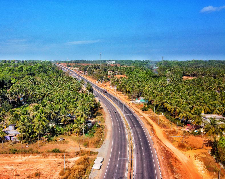
The highway in the state of Karnataka is being upgraded to international standard 60-meter wide grade separated highway, in whichvehicles can travel at a speed of 100 km per hour. It is a major overhaul, in which certain bridges are being constructed as six-lanebridges for the smooth movement of traffic. The widening work is going on in the complete stretch from the Goa border to the Keralaborder. The stretch between Talapady to Kundapura has been already converted to four lanes and the four-lane stretch betweenKundapura and Karwar is under progress.
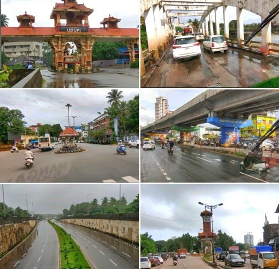
National Highway 66 of Karnataka Starts from Talapady to Karwar with the stretch of 293kms connecting 3 major district DakshinaKannada, Udupi & Uttara Kannada. and towns as Ullal, Mangalore, Suratkal, Mulki, Padubidri, Kapu, Udupi, Kundapura, Maravante,Bhatkal, Murudeshwara, Honnavara, Kumta, Gokarna & Ankola.
NH 66 passes through hills, forests, rivers, rivulets, and streams, generally flowing westwards towards the Arabian Sea. The NH66touches the Arabian Sea at Maravanthe in Karnataka,Most of the region has typical scenes like coconut trees dotted all along withpaddy fields and arecanut gardens. The road is uneven, and bumps, curves, steep rises and narrow paths in between hillocks arefound all over this highway. As this region experiences heavy rainfall, potholes are occasionally present.
Although the languages spoken vary along the highway, the food of the people along the NH 66 has some common ingredients likecoconut, chili, pepper, coconut oil, and fish. The region has a higher literacy rate. The building of National Highway 66 has led to rapiddevelopment of the towns and cities along the highway
